

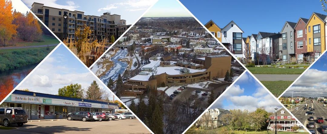
Annexation Area Amendments to the Municipal Development Plan & Land Use Bylaw
Consultation has concluded
Background
Since 2017, the City of St. Albert has been engaged in intermunicipal discussions with Sturgeon County regarding an annexation of lands. Through this process, the City of St. Albert has decided to explore annexation to allow for sustainable long-term growth consistent with the Edmonton Metropolitan Region Growth Plan, as well as providing certainty for residents, developers, and landowners. As the annexation applicant, the City of St. Albert undertook multiple forms of public engagement and completed all necessary technical studies required to support its application. The annexation negotiation process between the City of St. Albert and Sturgeon County has concluded, and in September 2020, the negotiated annexation agreement was approved by each municipality’s Council. The annexation has been approved by the Province.
Annexation results in changes to the common land boundary between subject municipalities, and transfers municipal jurisdiction from one municipality to another. With forthcoming boundary changes, subject to the Province's decision, the City will be required to amend Flourish, the Municipal Development Plan (MDP), as well as the Land Use Bylaw (LUB).
Municipal Development Plan Amendments
Amendments to the MDP will include, but not be limited to, updating maps to address the City's boundary change and future land use plans for the annexation area, as well as policy direction for the annexation area. Please refer to the draft map below.


Land Use Bylaw Amendments
Amendments to St. Albert's Land Use Bylaw (LUB) will include, but not be limited to, introducing two (2) new Land Use Districts:
- The Transitional (TD) Land Use District will guide and enable the transition of land uses in the annexation area, where appropriate. The district will allow existing uses of land to continue and certain types of subdivision. Please refer to the Key Documents section for additional details.
- The Alternate Jurisdiction (AJ) Land Use District is to provide for lands that do not require a development permit when falling under the jurisdiction of federal or provincial legislation. Please refer to the Key Documents section for additional details.

Who's Listening
-

Email cwalker@stalbert.ca -

Email ttsui@stalbert.ca
Videos

Key Documents
-
 City of St. Albert Municipal Development Plan (22.6 MB) (pdf)
-
Draft Urban Structure and General Land Use Map (736 KB) (jpg)
-
Draft Map of Priority Areas for Growth (2.09 MB) (pdf)
-
Draft Transitional Land Use District (135 KB) (pdf)
-
Draft Alternate Jurisdiction Land Use District (78.3 KB) (pdf)
-
What We Heard Report (314 KB) (pdf)

Administration's response to Mr. K. Crutchfield's questions below:
1. Map 3 has Lot 56 cross hatched, but no legend. What is intent for land use post annexation?
The intent is for Riverlot 56 to remain as is. The City does not have jurisdiction on this land and land use decisions will be made by the Province.
2. What imperative is being followed to identify so many lands as "Employment lands"?
This is in keeping with the proposed annexation studies and rationale for the proposed annexation, to increase our employment land base to promote sustainability and reduce the reliance on residential taxes.
3. I understood Council had directed that the employment lands south of Meadowview Drive were to be left for park use yet Map 3 shows otherwise?
Council made a Council Motion on May 31, 2021 for Administration to bring this back to Council for debate by Q3 (July-September) 2022.
4. The MDP Flourish calls for a minimum 50 meter setback from the top of bank of Carrot Creek and the Sturgeon River regardless of the lands within that setback being developable. Yet Administration permitted a 50 m building foot print (Bylaw 9/2021) to be identified within 17 m of top of bank. What assurances are there that the 50 m set backs will be honoured and not whittled away under the notion they contain developable land?
The last part of that policy states, “Or as determined through appropriate studies and plans, as deemed satisfactory by the City. The cost of supporting studies and plans are the responsibility of the applicant.” The applicant provided studies to support this development which were reviewed by the City and deemed satisfactory.
5. What rationale is applied to create a mixed use node at the eastern end of Bellerose Drive at the terminus of a ravine draining to the Sturgeon River?
A mix use node was identified in this location as it is a key intersection. Appropriate setbacks and stormwater management would be further defined at the ASP.
6. Why is there not more green space/parkland associated with Carrot Creek?
This map just shows what can be taken as Environmental Reserve, there could be an opportunity to have additional park space dedicated as Municipal Reserve. This will be further outlined within Area Structure Plans.
7. I understand the Province is intending to purchase the lands west of Ray Gibbon and south of 137th Avenue for consolidation of Lois Hole Centennial Park. What discussions has St. Albert had with the government to justify identifying the lands as employment lands?
Employment lands is the current designation under Flourish. This amendment focuses on assigning land uses to the proposed annexation area. If this area becomes a Provincial Park, Flourish could be updated at that time.
8. Why are some wetlands in the annexation area identified as major open space and yet not others of comparable size on map 3?
Some wetlands already have approval from the Province to be drained.
1. Map 3 has Lot 56 cross hatched, but no legend. What is intent for land use post annexation?
2. What imperative is being followed to identify so many lands as "Employment lands"?
3. I understood Council had directed that the employment lands south of Meadowview Road were to be left for park use yet Map 3 shows otherwise?
4. The MDP Flourish calls for a minimum 50 meter setback from the top of bank of Carrot Creek and the Sturgeon River regardless of the lands within that setback being developable. Yet Administration permitted a 50 m building foot print (Bylaw 9/2021) to be identified within 17 m of top of bank. What assurances are there that the 50 m set backs will be honored and not whittled away under the notion they contain developable land?
5. What rationale is applied to create a mixed use node at the eastern end of Bellerose Drive at the terminus of a ravine draining to the Sturgeon River?
6. Why is there not more green space/parkland associated with Carrot Creek?
7. I understand the Province is intending to purchase the lands west of Ray Gibbon and south of 137th avenue for consolidation of Lois Hole Centennial Park. What discussions has St Albert had with the government to justify identifying the lands as employment lands?
8. Why are some wetlands in the annexation area identifed as major open space and yet not others of comparable size on map 3?